
File:Aerial photograph of Manchester, Salford and Trafford.jpg
Size of this preview: 640 × 480 pixels.
| |
This is a file from the Wikimedia Commons. Information from its description page there is shown below.
Commons is a freely licensed media file repository. You can help. |
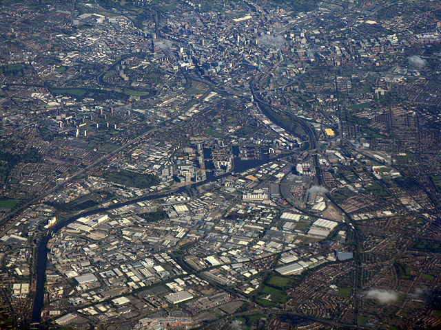
| Description | An aerial photograph of Manchester city centre (running along the top of the image), Salford (left half of the image) and Trafford (right half of the image), all of which are in Greater Manchester, England. Landmarks such as the bend in the River Irwell by Salford University, the Beetham Tower in Manchester city centre and Old Trafford in Stretford are all in this image. The docks of Salford Quays occupy the centre-part of this photograph. | |||||||
| Date | 7 October 2010 | |||||||
| Source | http://www.geograph.org.uk/photo/2103101 | |||||||
| Author | M J Richardson | |||||||
| Permission ( Reusing this file) |
|

| Annotations | This image is annotated: View the annotations at Commons |
File usage
The following pages on Schools Wikipedia link to this image (list may be incomplete):
Metadata
Learn more
SOS Childrens Villages has brought Wikipedia to the classroom. Thanks to SOS Children, 62,000 children are enjoying a happy childhood, with a healthy, prosperous future ahead of them. Sponsoring a child is the coolest way to help.